
Columbia ZIP Code Coverage
Richland County's Local Areas map lists postal categories in and around the county and cautions that ZIP boundaries can extend beyond county boundaries. The list below preserves the roles stated in the research. It is not a promise that every listed special-purpose code is a general delivery area. Use the USPS tool for an exact address, then independently check city limits and the parcel's county.
| ZIP | Areas Covered | Post Office | Notes |
|---|---|---|---|
| 29201 | Columbia delivery and core city | Columbia SC S&DC | 1601 Assembly St., 29201-9958; city and county limits need a separate check. |
| 29202 | Columbia PO Box category | Postal-only category | Not a neighborhood. |
| 29203 | Northern city edge and northern suburban or rural Richland | Columbia postal area | A planning document says it extends beyond the City. |
| 29204 | Columbia delivery area | Columbia postal area | Government addresses use it; it does not define city limits. |
| 29205 | Columbia delivery area and Devine tax-kiosk area | Columbia postal area | Check neighborhood and parcel authority separately. |
| 29206 | Columbia delivery area | Forest Acres Post Office | 4840 Forest Dr., 29206-9998; the postal designation may cross a city boundary. |
| 29207 | Fort Jackson and Columbia postal category | Fort Jackson Post Office | 4350 Century Division Ave., 29207-9996; County classifies Fort Jackson as PO Box. |
| 29208 | University of South Carolina category | USC postal category | A campus ZIP is not a City neighborhood roll. |
| 29209, 29210 | Southeast Richland and west Richland Columbia delivery areas | Columbia postal areas | Use an exact street USPS check. |
| 29211 | Columbia PO Box category | Postal-only category | Also appears in some government mail addresses, not as a situs conclusion. |
| 29212 | Columbia and Irmo-area postal geography | Columbia-area postal geography | Postal label may not match City limits. |
| 29213 | Not verified on the County map reviewed | Verify through USPS | Do not assign this code from a general map list. |
| 29214–29217 | Columbia unique ZIP categories | Unique or institutional category | Do not assign a general neighborhood. |
| 29218–29220, 29225, 29226 | Columbia unique or special categories | County local-area source | Exact current institution or use was not verified; check USPS. |
| 29221, 29224 | Columbia PO Box categories | Postal-only categories | Not neighborhood areas. |
| 29223 | Northeast Columbia and Richland delivery | Northeast Post Office | 8505 Two Notch Rd., 29223-9998. |
| 29229 | Northeast Columbia, Richland, and Sandhills delivery | Columbia-area postal geography | County tax kiosk at 1320 Clemson Rd.; it can reach beyond city or county lines. |
The documented table includes everyday delivery areas, PO Box categories, military and university categories, and unique codes. Its 29213 gap is deliberate: use it as a prompt to verify the precise delivery address, not as an invitation to guess.
Verify a Columbia ZIP Code
For a live address, use the official USPS ZIP Code Lookup rather than assigning a ZIP from a map. The relevant key is the complete delivery address. The County map is useful for broad orientation, but it expressly warns that ZIP geography can reach beyond county lines. A Columbia mailing label is not proof of incorporation, parcel jurisdiction, court venue, or election district.
| USPS lookup key | What it verifies |
|---|---|
| Full street delivery address | The postal ZIP assigned to that delivery address, including the ZIP+4 result when USPS provides one. |
| Post office or ZIP query | Postal lookup information for the entered place or code, not a property or resident search. |
The screenshot below records the official USPS ZIP Code Lookup surface. It is an address-verification channel, not a ZIP-wide record index.
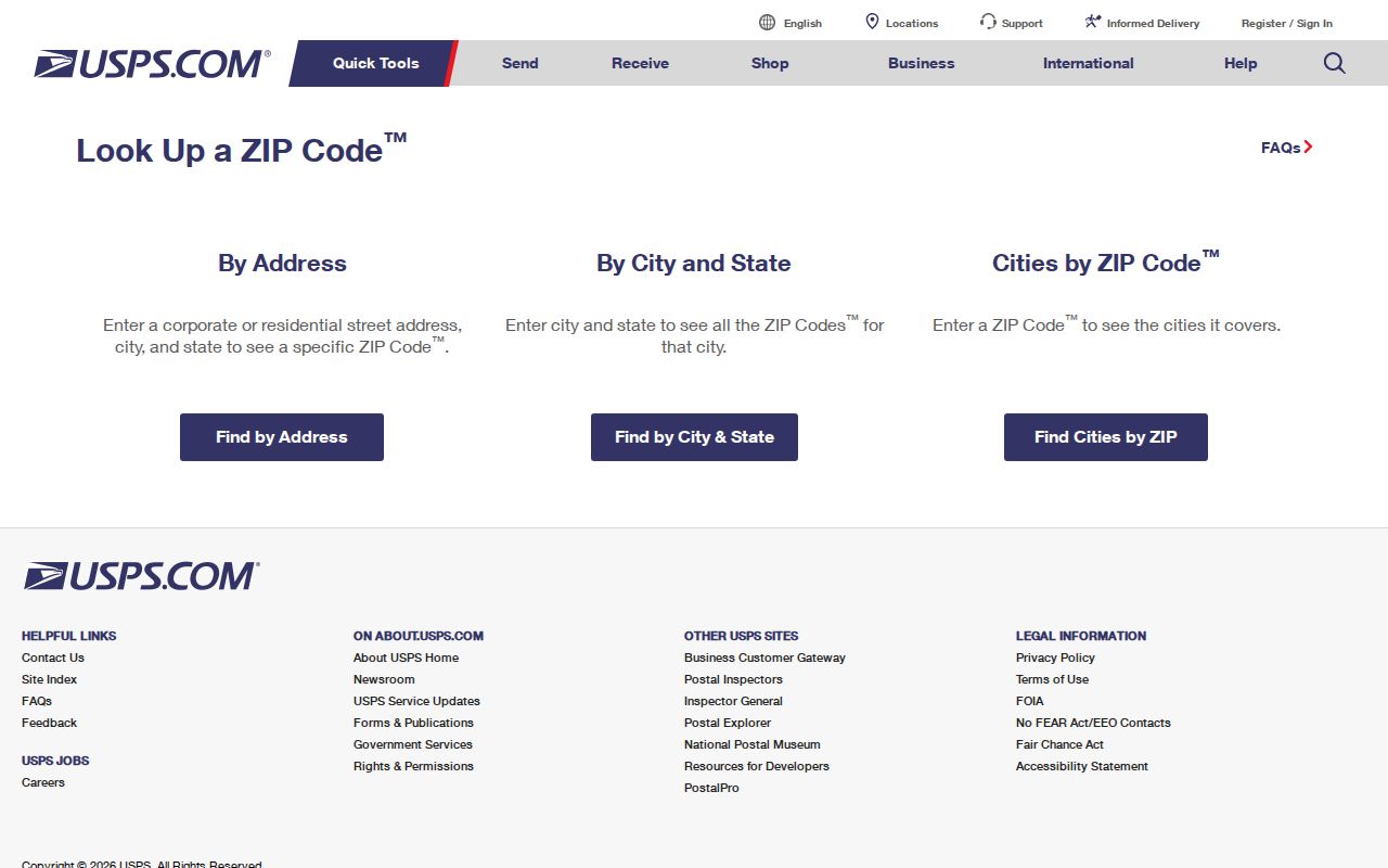
After USPS confirms the delivery ZIP, use the exact address or parcel number for local record work. That order prevents a postal label from being mistaken for a land-record boundary.
Columbia ZIP Code Geography
Columbia's addresses sit inside several nonmatching geographies: City of Columbia limits, Richland County parcels, some city addresses or municipal service that reach Lexington County, postal delivery areas, neighborhood maps, and school or election districts. The City publishes City Limits and Outside of City Limits layers, while the County ZIP map states that ZIP boundaries may extend beyond county boundaries. Each layer answers a different question.
Postal area, not legal boundary. A ZIP code can cross a city or county line. Confirm the city limit, county parcel, court, tax, and election jurisdiction independently for the particular address.
That caution is especially important for 29203, which extends to northern suburban and rural Richland, and for 29229, which can reach beyond city or county lines. The appropriate deed, tax, probate, or election office follows the parcel and jurisdiction, not the ZIP printed on an envelope.
Use ZIP Codes to Begin
No current Richland official property, ROD, or GIS ZIP-wide search mode was verified. The documented Property Card modes are Tax Map #, Address, and Owner. ROD modes are tax map, book and page, name or firm, address, and legal description. The County GIS guide uses address or parcel. A ZIP can help sort an address you already know, but it does not turn any of those official tools into a Columbia ZIP code directory of residents.
- Confirm the full delivery address with USPS, including the correct ZIP code.
- Use that exact address in Richland's property or GIS tools, or use the tax-map number if known.
- Read the returned situs, owner-of-record, and mailing labels as separate fields. Record the parcel's county before choosing a custodian.
- For a recorded land question, search the ROD with tax map, legal description, address, party, or book and page, then use the counter or copy process for older material.
- When a street has been narrowed, use the Columbia street directory workflow to compare parcel and historical address evidence one property at a time.
The City street layer includes LeftZip and RightZip fields, indicating that a street side can be associated with postal values. The reviewed research did not verify a public viewer control that exposes ZIP filtering, so those map fields should not be represented as a resident or owner search.
Use Columbia Parcel Keys
For property research, the durable link is not the ZIP. The situs is the physical street location used for parcel, map, or inspection orientation. A mailing address is a correspondence field and can differ for a legitimate reason. The legal description, such as a lot, block, subdivision, plat, or metes-and-bounds reference, is the land identity that can survive a changed street label. The tax map ties the county property card to that land context.
Richland's ROD recommends tax-map searching but warns that an address or tax-map number is not required on every recorded document. For a recorded chain, use the current parcel's legal description and acquisition instrument, then compare the derivation clause and earlier deed. A ZIP may be useful to confirm present delivery, but it is not a substitute for those parcel keys.
Note: A parcel owner, a tax mailing contact, and a recorded deed party each describe a limited record relationship, not an automatic residence finding.
Recognize Columbia's Special ZIPs
PO Box and unique ZIP categories deserve extra care. Richland's local-area source labels 29202, 29211, 29221, and 29224 as Columbia PO Box categories. It places 29214 through 29217 among Columbia unique categories and lists 29218, 29219, 29220, 29225, and 29226 as unique or special categories, without verifying the exact current institution or use in the sources reviewed. These are postal designations, not general neighborhood names.
- ZIP code
- A USPS delivery-area code that helps route mail. It does not set a municipal or parcel boundary.
- ZIP+4
- An added four-digit delivery refinement assigned by USPS to a more specific address or delivery segment.
- PO Box ZIP
- A postal category used for box service, which does not establish the physical location of a property.
- Unique ZIP
- A special-purpose postal category, often associated with an institution or organization rather than a broad neighborhood.
- Carrier route
- A mail-delivery grouping used by the Postal Service; it is not a legal boundary or a household list.
USPS verification is particularly important for the 29213 gap and for special categories where a source did not identify current use. Do not turn an institution-oriented code into a claim about nearby homes.
Columbia Addresses Before ZIPs
Historic address work does not begin with a modern ZIP. Columbia's 1786 capital plan used a 400-block grid, a useful clue when comparing an old number and cross street. The 1905 Street and Avenue Department also recorded a dated block-numbering and side-of-street convention. Pair a historical directory spelling with cross streets, the legal parcel, and the appropriate Sanborn map rather than mechanically assigning current postal geography to an older listing.
Street names changed over time. Local references identify Walnut for Blanding, Lumber for Calhoun, Upper for Elmwood, Medium for College, Green for Greene, and a historical Divine spelling for Devine. USC's Sanborn collection has Columbia editions from 1884 through 1923. These sources give building and street context, not a full occupant account, but they can explain why a present-day ZIP has little value in a much older address trail.
Columbia ZIP Code Limits
A ZIP code directory is most accurate when it stays within postal facts. It can help verify a delivery address, distinguish PO Box and special categories, and flag a geographic mismatch. It cannot draw title lines, identify all people at an address, or decide whether Richland or Lexington County holds a particular record. Those answers require a city-limit layer, tax map, legal description, and the right custodian.
For historical research, start with the street address, grid position, cross street, and parcel trail. City and telephone directories, deeds, plats, and Sanborn maps predate many modern postal practices. A current ZIP should enter the research only when confirming modern delivery. Record the source date beside the postal result. That source-by-source approach protects against treating a postal code as if it were an unchanging local boundary.